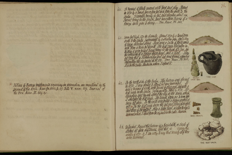
The Bronze Age Landscape occupied pride of place in the work of Peter Orlando Hutchinson – the Farway, Gittisham, Broad Down Complex is one of the richest Bronze Age ritual and funerary landscapes in the South West. Follow in his footsteps and see the landscape as shown in his illustrations.

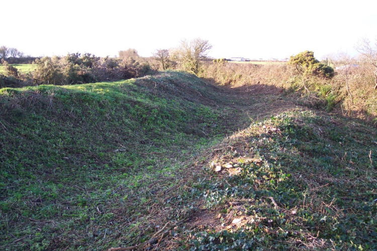
Sidbury Castle
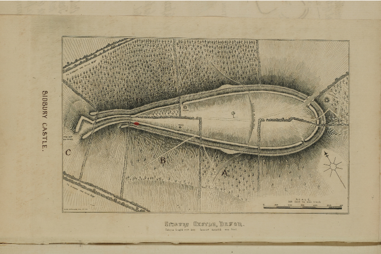
POH Sidbury Castle
Sidbury Castle
What will I see?
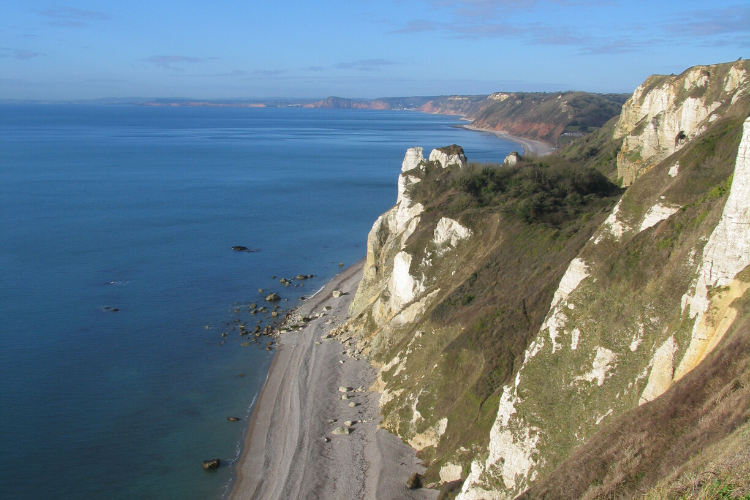
Sidbury Castle is an impressive East Devon Iron Age hillfort. It has never been tested archaeologically but the characteristic shape and the finds which have come to light over the years certainly support the dating. On the ground there are visible remains such as ditches and banks.
Today it is managed by landowner agreement with Historic England.
How do I get there?
Access is via guided tours only.

Mutters Moor
What will I see?
This, the site of a now disappeared stone circle attributed to the Bronze Age, appeared on several early maps, including early OS maps.
The stones were removed to grace a rockery at Bicton before Hutchinson could record them, but he interviewed two labourers in Otterton who had been employed to move them. The depiction of the stones in two of the maps suggests the stones were no longer in a circle when they were removed..
How do I get there?
Nearest car park is at Peak Hill SY 311 871. To find the site of the Seven Stones follow the track to the east side of the car park. The surrounding heath land is open access served by a network of paths.
Can I find out more?
We have copies of Geophysical survey reports (2011-12) and map analysis available on request.
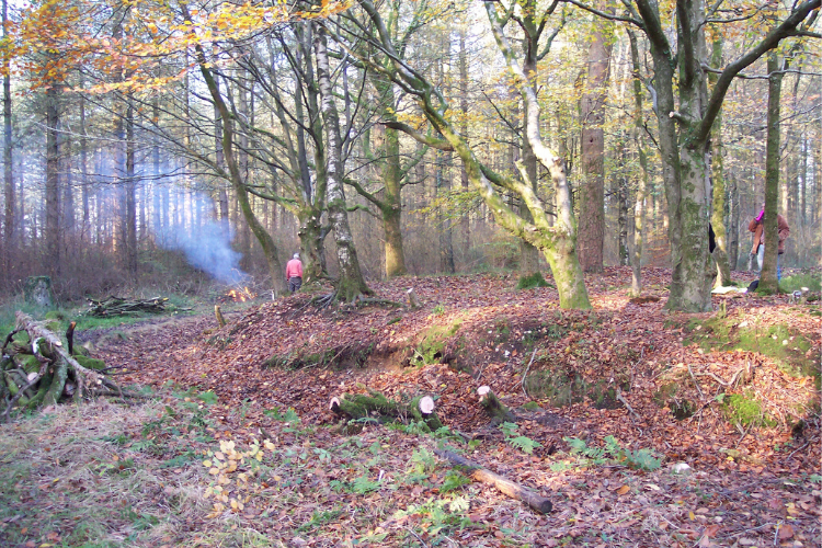
East Hill
What will I see?
Two star-shaped barrows and a small enclosure (scheduled). East Hill is surprisingly rich in archaeology.
How do I get there?
These sites are within Open Access woodland and can be seen from the road.
Can I find out more?
We have a report on the Napoleonic military sites and a prehistoric ceremonial monument on East Hill available on request.
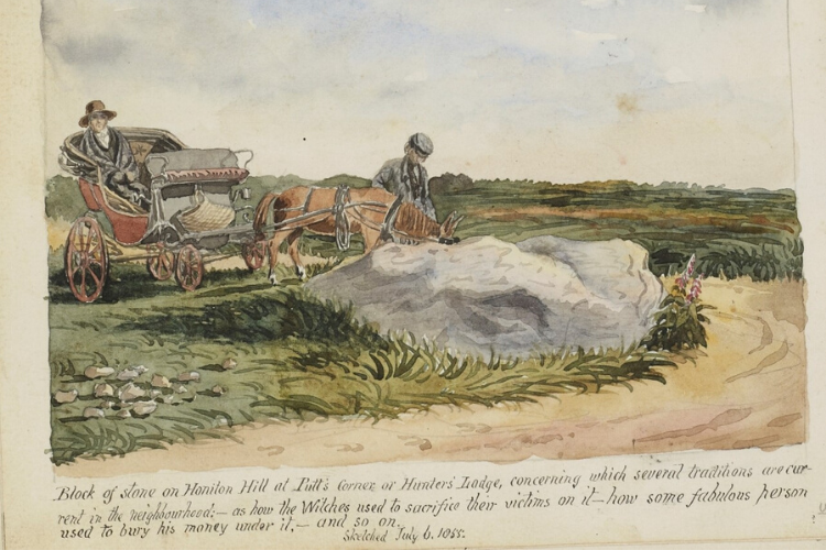
Putt's Corner Stone
What will I see?
This stone is the stuff of legend and is variously called the ‘Slaughter Stone’ and the ‘Witches Stone’. . Believed to be Bronze Age, it is known to have been moved at least once in road widening and can now be viewed in the shrubbery in front of the Hare and Hounds Inn. The stone’s silcrete composition indicates that it is of local origin and forms part of a little understood distribution of stones along ancient trackways and cross-ways which have now become modern roads.
How do I get there?
The Hare and Hounds is located on the A375 and can be reached via the local bus services between Honiton and Sidmouth.
Can I find out more?
We have an article on the site by Philippe Planel available on request. There is some interpretation within the Hare and Hounds Inn.
Gittisham Hill near Ring in the Mire
What will I see?
Between Putts Corner and Farway Castle lie a number of barrows. Unlike the barrows immediately beyond Farway Castle on the south side of the road, these barrows are on land accessible to the public (from either Ring in the Mire itself or through a gate immediately opposite the Hare and Hounds at Putts Corner).
Ring in the Mire is a very intriguing feature, also the subject of a legend and a spot on which four ancient parish boundaries converge.
How do I get there?
Best accessed from the Hare and Hounds on the A375 (using local bus service). The sites are on Gittisham Hill which is an Open Access area. Stout footwear is recommended.
Can I find out more?
We have a survey report of Gittisham Enclosure and plan of the enclosure by Hazel Riley available on request.
")
Farway Common Barrows
What will I see?
These barrows are on private land. The landowner has previously allowed groups, which have been pre-booked, to walk through this fascinating barrow landscape, where you can see huge individual barrows as well as a row of smaller ones.
How do I get there?
The barrows are visible from the roadside but there is no nearby car park other than at Knapp Copse Local Nature Reserve. At the moment, we do not have a team member to assist in guided walks.
Can I find out more?
Artefacts found at this location can be seen at the Royal Albert Memorial Museum in Exeter
Seven Barrows Field
What will I see?
This is an iconic Hutchinson site, not just because he named it but because he witnessed the enclosure of this previously open heath and subsequent improvement for grassland, which, as a result, has made it impossible today to identify all seven barrows.
Today, the curious can lean on the gate of the field and look at the only two large barrows still visible, from which important finds (now on display at the RAMM Exeter) were excavated in the 19th century, in conditions which we would regard as far from ideal today.
How do I get there?
Access is via guided tours only.
Can I find out more?
Artefacts found at this location can be seen at the Royal Albert Memorial Museum at Exeter
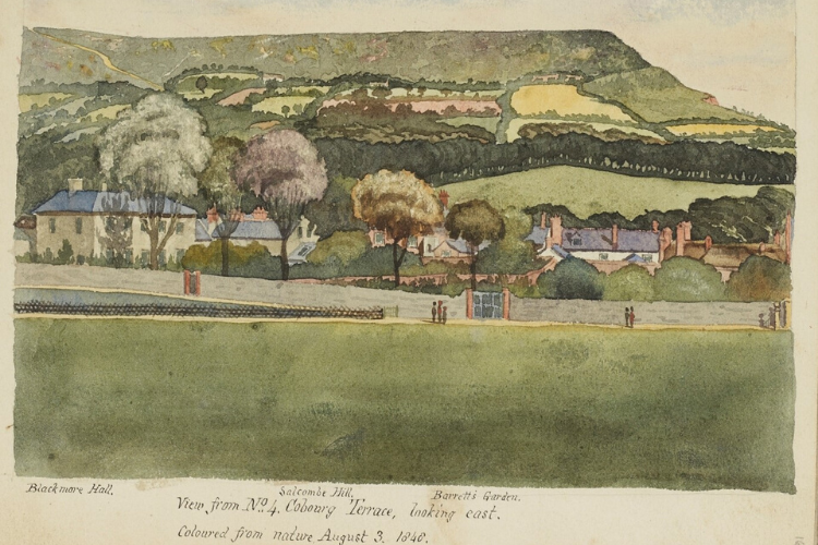
Salcombe Hill
What will I see?
Two distinct standing stones are known to have been moved in the time between POH’s 1874 map and Pollard’s 1978 plan.
A further stone was discovered by an oral history interview, located by David Hurford (Farwood Barton – Colyton) and re-erected by the Donkey Sanctuary.
How do I get there?
Park at Salcombe Hill car park on the coast road out of Sidmouth and take the coast path east. Both visible from public footpaths
Blackbury Camp
What will I see?
Iron Age Hillfort with elaborate south entrance – the enclosure at Blackbury is oval in shape, roughly 200mtrs (660ft) long by 100mtrs (330ft) wide. Surrounding it is an impressive rampart, now about 3mtrs (10ft) high and up to 10mtrs (33ft) wide. This is built from clay and flint quarried from an outer ditch which measures up to 12mtrs (39ft) wide.
The single entrance on the south side is defined by large ramparts. It was about 5mtrs (16ft) wide and would originally have been rivetted with timber and contained a large gateway with timber gates, possibly set within a timber gate – tower. The ground surface around the entrance was gravelled with pebbles from the stream below, suggesting that heavy use was expected during the wetter months of the year. Three other gaps in the ramparts are thought to be more recent features.
The most remarkable feature of Blackbury Camp is the earthwork in front of the entrance, which is triangular in shape and flanked by a bank and ditch. Settlements of this period usually have additional outer enclosures but these are normally arranged in concentric circles around the main one. We do not know whether the outer enclosure at Blackbury Camp was intended to be defensive or whether it had a practical use, perhaps as a holding area for cattle.
How do I get there?
With its own car park, Blackbury Camp is signed from the Seaton Road – Map Reference SY188 924
Can I find out more?
See our publications page for the Blackbury Camp leaflet

Littlecombe
Berry Camp
Berry Camp & Littlecombe Prehistoric Field System
What will I see?
Believed to be an Iron Age enclosure, with associated barrows and features west of the camp towards Littlecombe Shoot. Camp and other features cleared of vegetation by POH and Unlocking Coastal Heritage projects s.
How do I get there?
Use the coast path between Branscombe and Weston Mouth but also accessible via a footpath from Berry Barton Farm. All the remains are clearly visible from The South West Coast path, although there is no public access within the camp.
Branscombe can be accessed via the 899 Bus Service, alighting at the Fountain Head Inn for the nearest stop.
Can I find out more?
We have a report on the history and archaeology of Berry Camp prepared by AC Archaeology, available on request.
Please see our publications page for a local walk guide:The Mason’s Trail
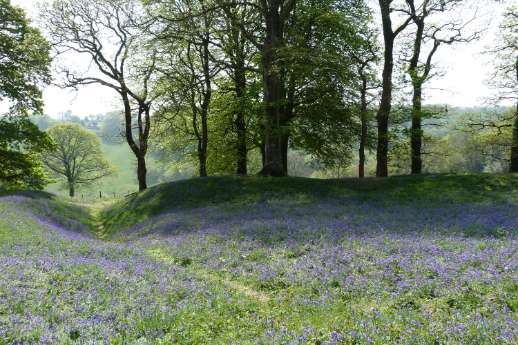
Ball Hill
What will I see?
This linear alignment of Bronze Age barrows can be viewed by the public. The barrows proved to be both unusually rich in artefacts and to contain very different internal structures when excavated by the Rev Kirwan of Gittisham. Hutchinson was critical of Kirwan’s methods and his almost non-existing recording.
How do I get there?
The site is on Open Access land is visible from the public bridleway; there is limited parking at SY172 944
Can I find out more?
There are illustrations of the site from Peter Orlando Hutchinson’s History of Sidmouth Part 1, available in Sidmouth Museum
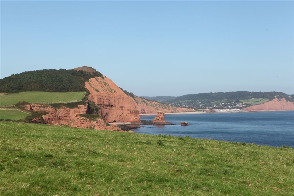
Beer Head
Remains of prehistoric field boundaries and a romano-british farmstead. The site of a Napoleonic gun battery and remains of R.A.F Beer Head, a Second World War radar station, all on a prominent chalk headland offering superb coastal views westwards to Sidmouth and beyond and eastwards as far as Portland Bill, on a clear day.
How do I get there?
There is a car park at Beer Head, just follow the signs from Beer village centre. Alternatively, Beer is served by the X53, 52A and the 899 bus services and then follow the coast path signs out onto the cliff top fields.
Where can I find out more?
There are interpretation boards on site on Beer Head as a defensive site through the ages and early settlement
See our publications page for the Beer Head Time Trail leaflet
An archaeological report about Beer Head, prepared as part of the Unlocking Coastal Heritage project, is available on request
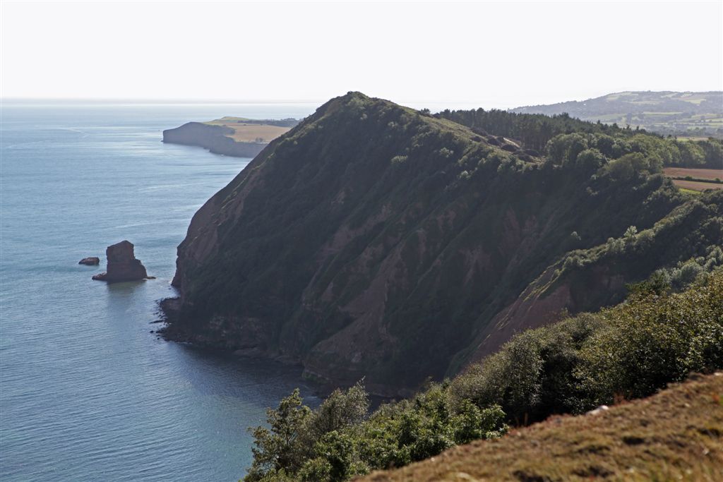
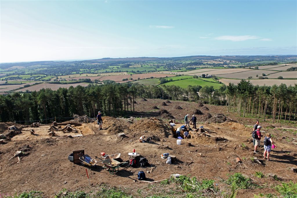
High Peak
What will I see?
There are remains of ramparts and ditches still visible on site. The recent excavations have confirmed the dating of High Peak, with occupation in two discrete unrelated time frames – the Neolithic (prehistoric period – 4000-2000 BC) and Dark Age (early historic period following the end of the Roman Empire – 6th century AD).
How do I get there?
High Peak is best approached along the South West Coast Path. Park at Peak Hill car park on the coast road west from Sidmouth and cross the road and walk out to the cliff edge where you will join the coast path . Alternatively catch the 157 bus to Otterton and join the coast path at Ladram Bay before ascending High Peak.
Can I find out more?
There are two interpretation boards, one on the cliff top at Peak Hill and the other on High Peak itself, telling you all about the site.

Woodbury Castle
What will I see?
Woodbury Castle is not a medieval castle but a prehistoric hillfort. It is located at 175m above sea level east of the Exe Estuary and gives extensive views of the surrounding countryside. The ramparts and ditches are well conserved and extensive.
How do I get there?
Woodbury Castle lies on the B3180, the Exmouth to West Hill road. There is a car park and a bus to nearby Woodbury.
Where can I find out more?
There is interpretation on site.
More to Explore

Our National Landscape Projects
We lead, partner and support projects that focus on a wide range of themes, including landscape and heritage, environmental quality and climate, biodiversity, recreation and tourism.

Outdoors & Active
Whether you prefer walking, cycling, running or playing, everyone feels happier and healthier when they spend time in nature being more active.

East Devon Way
Discover the hidden gems of East Devon and explore this much loved walking route that links 40 miles of public footpaths, trails and bridleways.